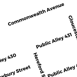
27HF29 MASSACHUSETTS AV
Owner Information
DONN O C 29-27H MASS AV LLC
29 MASSACHUSETTS AV
BOSTON, MA 02115


Property Details
27HF29 MASSACHUSETTS AV is classified as a Mixed Use (Primarily Residential, some Commercial) (Apt 4-6 units).
The primary structure on this property was built in 1899. There are 6,675ft2 of built area within this property. There is 5,478ft2 of residential/living space within this property.
27HF29 MASSACHUSETTS AV is valued at $2,317,000. The land is valued at $918,800 and the structures are valued at $1,396,000. There is an additional valuation of $2,200 on this property.
The most recent deed for 27HF29 MASSACHUSETTS AV is recorded at the local registrar in Book 24779, Page 131. 27HF29 MASSACHUSETTS AV was last sold on Thursday, March 23, 2000 for $9.
Assessment data from fiscal year 2020.
Flood Data
According to the FEMA National Flood Hazard Layer, this property does not appear to be in a flood zone. It may also be in an area not yet reviewed. Nonetheless, confirm this information prior to taking any action.
To view the flood hazards around this property, create a FEMA "Firmette" Map of the area around 27HF29 MASSACHUSETTS AV.
Broadband Internet Providers
| Provider | Type | Bandwidth (mbps) | |
|---|---|---|---|
| HughesNet | Satellite | 25 | 3 |
| Verizon New England Inc. | Fiber | 940 | 880 |
| Verizon New England Inc. | DSL | 15 | 1 |
| Crown Castle Fiber | Fiber | 0 | 0 |
| Viasat Inc | Satellite | 100 | 3 |
| Starry, Inc. | Fixed Wireless | 200 | 200 |
| netBlazr Inc | Fixed Wireless | 50 | 50 |
| T-Mobile | Fixed Wireless | 25 | 3 |
| GCI Communication Corp. | Satellite | 0 | 0 |
| VSAT Systems, LLC. | Satellite | 2 | 1 |
| Comcast | Cable | 1000 | 35 |
Broadband service provider data from December 2020.
Adjacent Properties
- 495-497 BEACON ST 1
Residential Condominium owned by PARK YOUNG JIN - 495-497 BEACON ST
Other, Open Space owned by FOUR-95 497 BEACON ST CONDO - 495-497 BEACON ST C-1
IMPUTED - Commercial owned by BEACON STREET REALTY TRUST - 495-497 BEACON ST 3
Residential Condominium owned by ATKINS AMANDA J - 495-497 BEACON ST 4
Residential Condominium owned by KOZO INC - 495-497 BEACON ST 5
Residential Condominium owned by ZHANG CHI - 495-497 BEACON ST 6
Residential Condominium owned by TENORE BRENNA - 495-497 BEACON ST 7
Residential Condominium owned by CUADRA RUY ALVAR - 495-497 BEACON ST 8
Residential Condominium owned by GOYAL ROHIT - 495-497 BEACON ST 9
Residential Condominium owned by CHIN MAY K - 495-497 BEACON ST 10
Residential Condominium owned by CASA DE SHAHIN LLC MASS LLC - 495-497 BEACON ST 2
Residential Condominium owned by VAZQUEZ GENARO - 2725 MASSACHUSETTS AV
Mixed Use (Primarily Residential, some Commercial) owned by RICUPERO DAVID G